Breezy Sunshine and Chilly Flurries: A Detailed Look at Cleveland’s Wednesday Forecast

Midweek Weather Overview
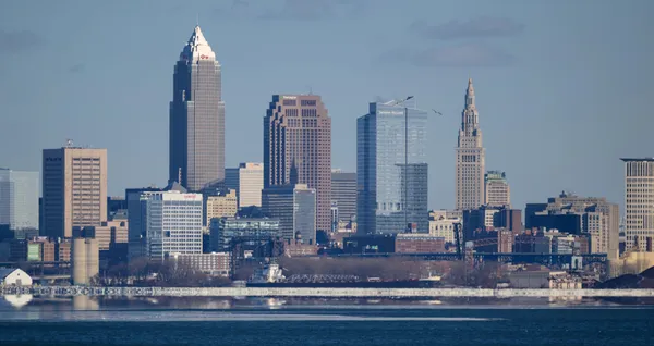
Cleveland residents waking up this Wednesday, February 25, 2026, can expect a blend of late-winter sunshine and biting winds as a fast-moving system approaches the Great Lakes. While the day starts with a hint of brightness, the lead editor at Cleveland News advises keeping your heavy coat and gloves handy. A combination of fluctuating temperatures and lake-effect potential will define the next twenty-four hours in the Forest City.
Morning: A Crisp and Clear Start
The morning hours will begin with temperatures hovering in the mid-30s. As of 7:00 AM, the mercury is expected to sit at approximately 36°F, though a steady wind from the west-southwest at 18 MPH will make it feel significantly colder—likely in the mid-20s. Commuters should see mostly clear to partly sunny skies during the early drive, with visibility remaining high. By 10:00 AM, the temperature will climb slightly to 38°F. While the sun may offer a psychological reprieve from the winter chill, the humidity will remain near 70%, keeping a damp edge to the morning air.
Afternoon: Peak Temperatures and Gusty Conditions
Temperatures are projected to peak around midday, reaching a high of approximately 40°F to 41°F. This afternoon window will be the warmest part of the day, though the wind will remain a constant factor. Sustained winds of 15 to 20 MPH will continue to buffet the downtown area and lakeshore communities. By 3:00 PM, the cloud cover will begin to increase as a cold front begins its descent toward Northeast Ohio. Expect the thermometer to start its downward trek early, dropping back to 35°F by late afternoon.
Evening and Night: Turning Colder with Snow Potential
As the sun sets, the primary weather story shifts to a cold turn and the potential for precipitation. Forecasters are tracking a brief round of snow and wind expected to move through the region tonight. While widespread heavy accumulation is not currently expected, a 20% chance of snow showers could lead to a light dusting, particularly in the primary snow belt east of the city. By 9:00 PM, temperatures will fall to 30°F, eventually bottoming out near 24°F in the overnight hours. Lake-enhanced snow flurries may continue into the early morning of Thursday, potentially creating a few slick spots for tomorrow's early travelers.
Today's Forecast at a Glance
- High Temperature: 41°F
- Low Temperature: 24°F
- Wind Speed: 18 MPH WSW, with higher gusts possible near the lake.
- Precipitation: 20% chance of evening snow showers.
- Sky Conditions: Partly sunny morning giving way to an overcast evening.
Cuyahoga County judge to sentence Jeffrey and Lanaemarshe Grant in killing of 10-year-old Kaden Coleman

Downtown Cleveland traffic lights go dark Thursday morning, forcing four-way stops and complicating commutes

Two people killed in Maple Heights early-morning single-vehicle crash on Broadway Avenue, police investigate cause