Winter Storm Warning Expanded Across Ohio as Heavy Snow, Blowing Snow and Bitter Cold Target Travel
Statewide alert as storm system crosses the Ohio Valley
A Winter Storm Warning is in effect across Ohio as a large winter system spreads snow and, in some areas, mixed precipitation into the region. Forecast offices serving Ohio have issued warnings covering multiple parts of the state, with hazardous travel expected to develop and persist through the weekend and into Monday, Jan. 26.
The warning setup differs by region, reflecting variations in storm timing and intensity. In northern Ohio, warning areas include counties along and near Lake Erie’s western basin and nearby inland counties where periods of heavier snowfall are expected to peak on Sunday and taper late Sunday night into Monday morning. In the southern half of the state, snow is expected to be accompanied by pockets of sleet or other mixed precipitation at times, adding uncertainty to total accumulations and increasing the likelihood of rapidly changing road conditions.
Expected impacts: difficult travel, low visibility, and slow recovery
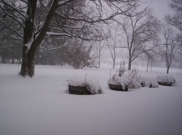
Across Ohio, the primary impacts are expected to be dangerous driving conditions from snow-covered roads, reduced visibility during heavier bursts, and blowing snow in open areas. Forecast discussions tied to the warnings also highlight that very cold air will follow the storm, which can complicate snow and ice removal and extend the duration of slick conditions even after precipitation tapers.
Wind chills below zero are expected at times during the warning period, increasing risks for motorists who become stranded and for anyone spending prolonged time outdoors. The cold may also lengthen response times for cleanup and restoration efforts where icing or heavy snow leads to isolated utility issues.
What forecasters are calling for in different parts of Ohio
Northern counties: Several warning areas call for heavy snow with projected totals in the mid-single digits up to around 8 inches, with the most intense snowfall expected Sunday and lighter snow lingering into early Monday.
Southern and southwestern Ohio: Forecasts indicate higher potential totals in the broader storm corridor, with the possibility of mixed wintry precipitation at times. The heaviest snow is expected from late Saturday into Sunday.
Statewide theme: Temperatures and wind chills are expected to fall sharply behind the storm, limiting melting and increasing the chance that untreated surfaces remain hazardous.
Safety guidance and travel planning
Drivers are urged to postpone nonessential travel during the heaviest snowfall and to plan for rapidly deteriorating conditions. For those who must drive, winter preparedness steps include carrying extra food, water, a flashlight, and warm clothing, and allowing additional time for travel. Conditions are expected to remain problematic into the Monday morning commute in multiple parts of the state.
Key risk window: late Saturday through Sunday, with lingering impacts into Monday, Jan. 26, especially where heavier snow bands persist.
Forecast details—including snow totals and the north-south placement of any mixed precipitation—may shift as the storm evolves. Residents should monitor local alerts and be prepared for warning expansions or timing adjustments through the weekend.