Subzero Wind Chills and Snow Squalls: A Frigid Monday for Cleveland
Arctic Front and Lake Effect Snow Grip the Forest City
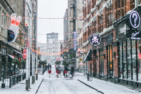
Northeast Ohio is currently gripped by an intense arctic air mass that has turned the region into a deep freezer this Monday, January 26, 2026. Following a significant winter storm that blanketed the city over the weekend, Clevelanders are now contending with the sharp "bite" of an arctic front. This weather system has brought dangerously low temperatures and the threat of persistent lake effect snow squalls to the lakeshore and inland counties alike.
Morning: Bitter Cold Impacts the Commute
As of the early morning hours, the temperature in Cleveland stood at a frigid 15°F, with the "feels like" temperature hovering around 0°F due to sustained gusty winds. Many residents encountered light snow showers and slippery road conditions during the morning rush. Meteorological reports indicate that wind-chill values across the region have been fluctuating between -15°F and -25°F in some areas, posing a significant risk for frostbite on exposed skin. An initial burst of snow moved through the metro area between 5:00 AM and 8:00 AM, leading to several reported traffic delays on major interstates.
Afternoon: Tracking Localized Snow Squalls
The forecast for the afternoon remains bleak, with the high temperature projected to reach only 17°F. The primary concern for the second half of the day is the development of lake effect snow squalls. While the general chance of snow is approximately 45%, these squalls are expected to be localized and intense, capable of creating sudden whiteout conditions. Experts at the National Weather Service warn that these afternoon squalls are often the most problematic for drivers, as they can cause rapid changes in visibility and road surface traction. Brisk winds will continue to sweep off Lake Erie, ensuring that the air remains bitingly cold even during the few hours of daylight.
Evening: A Deep Freeze Overnight
As the sun sets on this frigid Monday, the intensity of the lake effect snow is expected to taper off, leaving a 20% chance of light snow showers into the night. However, the drop in temperature will be the main concern for the evening hours. The mercury is forecast to plunge to a bone-chilling low of 4°F by early Tuesday morning. With humidity levels expected to remain around 72%, the cold will feel particularly heavy and penetrating. Local authorities recommend that residents check on elderly neighbors and ensure that all pets are kept indoors.
Active Alerts and Safety Recommendations
Several weather notices and local ordinances are currently active to manage the hazardous conditions:
- Winter Weather Advisory: This remains in effect for multiple counties throughout Northeast Ohio due to blowing snow and lake effect accumulations.
- Extreme Cold Warning: A warning is active through the midday hours as officials advise against prolonged outdoor exposure.
- Parking Bans: Several municipalities, including Cleveland Heights, have implemented city-wide street parking bans to allow snowplow crews to clear primary routes safely.
Commuters are urged to slow down, maintain significant following distances, and carry an emergency kit containing blankets and flashlights if travel is necessary today.