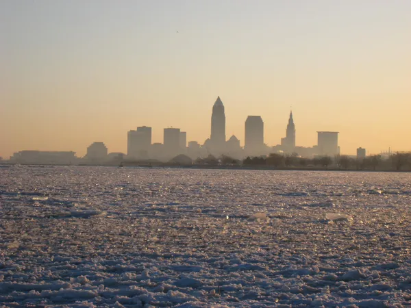
Cleveland faces possible sub-zero air temperatures this week as Arctic blast tightens its grip
A cold snap with potentially rare readings
Cleveland is entering a stretch of winter weather that could bring air temperatures below 0 degrees Fahrenheit, a threshold the city does not reach every year. Forecast guidance for mid-to-late January points to an Arctic air mass overspreading the Great Lakes, with the coldest conditions expected overnight when winds relax and temperatures fall fastest.
Sub-zero values refer to the actual air temperature, not the wind chill. Wind chill can drop well below zero even when the thermometer remains above it, because strong winds accelerate heat loss from skin.
When Cleveland last dropped below zero
Historical temperature records indicate Cleveland’s most recent below-zero air temperature occurred on January 22, 2025. That makes any sub-zero reading this week notable not because it is unprecedented, but because it remains infrequent enough to stand out in the city’s year-to-year climate record.
For additional context, Cleveland’s coldest temperature on record is far below that threshold, reaching 20 degrees below zero on January 19, 1994. February can also deliver extreme cold: the lowest February temperature recorded in Cleveland is 17 degrees below zero, observed on February 20, 2015.
What is driving the cold
The broader pattern behind this week’s chill is tied to a large-scale southward push of Arctic air across the Midwest and the Northeast, a setup often described in public forecasts as being associated with the polar vortex pattern. While the polar vortex is a persistent feature of the winter atmosphere, disruptions and shifts in the jet stream can allow colder air to spill south into the Great Lakes and Ohio Valley.
What residents can expect: temperature, wind and snowbelt effects
In addition to the risk of sub-zero air temperatures, strong winds are expected to create sub-zero wind chills at times. That combination increases the likelihood of hazardous outdoor conditions, including an elevated risk of frostbite on exposed skin during prolonged exposure.
Air temperature: The primary concern is overnight lows, when readings are most likely to dip below 0°F.
Wind chill: Gusty conditions can push “feels-like” temperatures far lower than the air temperature.
Snow: Cold, unstable air over Lake Erie can enhance lake-effect snow, especially in the primary snowbelt east of Cleveland, potentially impacting travel and visibility.
Key distinction: a “sub-zero” forecast can mean either sub-zero wind chills or sub-zero air temperatures, and the impacts differ.
Why the timing matters
Below-zero air temperatures tend to magnify routine winter challenges: they can stress vehicle batteries, increase the risk of frozen pipes in vulnerable buildings, and complicate road treatment effectiveness when temperatures fall low enough that some de-icing strategies perform less efficiently. With the cold arriving alongside periods of wind and snow, Clevelanders may see a combination of weather-driven disruptions rather than a single hazard.